Search
Filters
77 Search Results For
"map"
Goff’s Historical Map of the Spanish-American War in the West Indies, 1898, map by Eugenia Wheeler Goff and Henry Slade Goff, published 1899
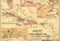
Goff’s Historical Map of the Spanish-American War in the West Indies, 1898, map by Eugenia Wheeler Goff and Henry Slade Goff, published 1899
The Gold and Coal Fields of Alaska Together with the Principal Steamer Routes and Trails, map by U.S. Geological Survey, 1898
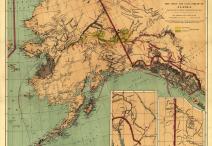
The Gold and Coal Fields of Alaska Together with the Principal Steamer Routes and Trails, map by U.S. Geological Survey, 1898
Map of Alaska: Showing Known Gold-bearing Rocks, by the U.S. Geological Survey, 1898
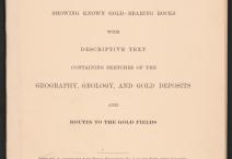
Map of Alaska: Showing Known Gold-bearing Rocks, by the U.S. Geological Survey, 1898
Geologic Map of the Grand Canyon . . . , Northwestern Arizona, map by George H. Billingsley for the U.S. Geological Survey, 2000
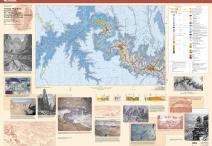
Geologic Map of the Grand Canyon . . . , Northwestern Arizona, map by George H. Billingsley for the U.S. Geological Survey, 2000
“Panorama from Point Sublime,” digital panorama comprising three illustrations by William Henry Holmes for the U.S. Geological Survey, Atlas to . . . the Tertiary History of the Grand Cañon District, 1882
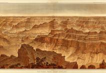
“Panorama from Point Sublime,” digital panorama comprising three illustrations by William Henry Holmes for the U.S. Geological Survey, Atlas to . . . the Tertiary History of the Grand Cañon District, 1882
“Geological Map of the Western Part of the Plateau Province,” map by the U.S. Geological Survey, Atlas to . . . the Tertiary History of the Grand Cañon District, 1882
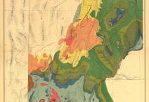
“Geological Map of the Western Part of the Plateau Province,” map by the U.S. Geological Survey, Atlas to . . . the Tertiary History of the Grand Cañon District, 1882
Tertiary History of the Grand Cañon District with Atlas, by Clarence E. Dutton, 1882
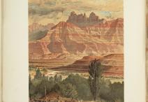
Tertiary History of the Grand Cañon District with Atlas, by Clarence E. Dutton, 1882
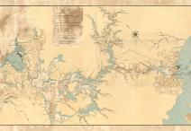
Western Hemisphere . . . Showing Routes for Steam and Sail, map accompanying the report of the First Isthmian Canal Commission, 1901
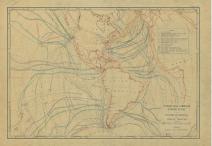
Western Hemisphere . . . Showing Routes for Steam and Sail, map accompanying the report of the First Isthmian Canal Commission, 1901
Map Showing Line of Proposed Lock Canal with Summit Elevation at 85 feet, map by the Isthmian Canal Commission, 1906
Map Showing Line of Proposed Lock Canal with Summit Elevation at 85 feet, map by the Isthmian Canal Commission, 1906
Strategic Map of Our War with Spain, map by F. H. Taylor for The War Map Publishing Company, 1898
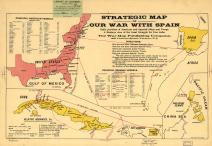
Strategic Map of Our War with Spain, map by F. H. Taylor for The War Map Publishing Company, 1898